")
Representing a Hilly or Mountainous Area on a 2D Map for Campsites and Tourist Villages
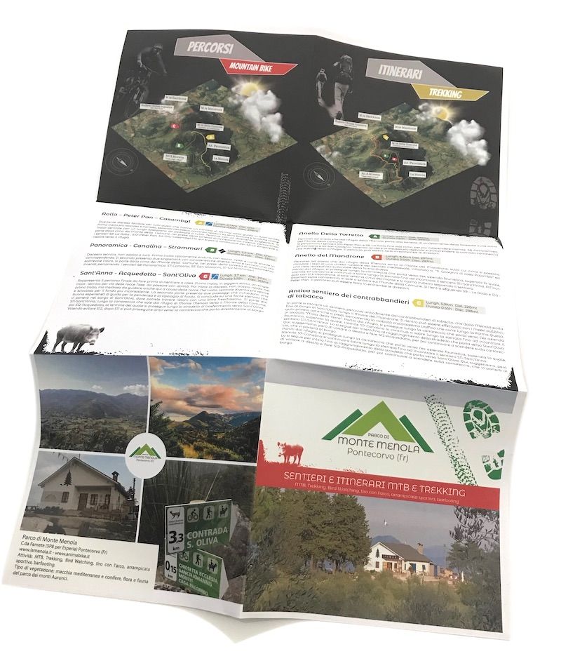
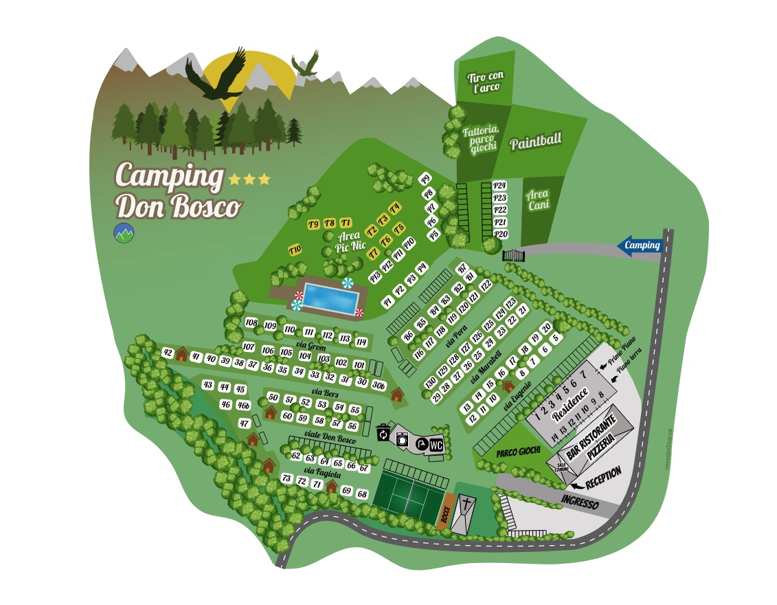
Recently, a client commissioned me for a project involving the map of a campsite. They wanted to emphasize that a portion of the camping area was situated within a hilly olive grove, and it was important to convey this information clearly on the map. Maps for campsites or tourist villages are essential tools for navigating unfamiliar spaces, but the challenge lies in accurately depicting the complexity of a hilly or mountainous area on a two-dimensional representation. In the context of campsites and tourist villages, accurately mapping such terrains is crucial to ensuring a positive experience for guests. In this article, we will explore best practices for effectively and intuitively representing hilly and mountainous features on 2D maps.
Elevation and Contours
The key to a detailed representation of a hilly or mountainous area lies in visualizing the elevation of the terrain. By using contour lines, it is possible to precisely outline variations in altitude, allowing users to easily grasp the surrounding topography. This is particularly useful for campsites and tourist villages situated in hilly regions, as it provides crucial information about slopes and changes in altitude that can impact accessibility and activity planning.
Trails and Scenic Routes
In hilly and mountainous territories, trails offer an exciting way to explore the surrounding nature. Representing these trails on the map with a distinctive and clearly visible style enables guests to plan hikes and outdoor activities optimally. The use of dashed lines to indicate trails and scenic areas provides a clear indication of recommended routes, enhancing the overall experience for visitors.
Points of Natural Interest
A hilly or mountainous area is often characterized by natural points of interest, such as peaks, lakes, and waterfalls. Emphasizing these features on the map with clear and descriptive icons allows guests to easily identify key attractions. Including additional information, such as the altitude of a peak or the depth of a lake, further enriches the understanding of the surrounding terrain.
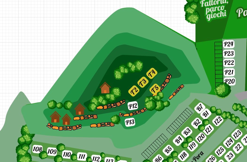
Services and Infrastructure
Alongside the representation of the natural landscape, it is crucial to highlight services and infrastructure within a campsite or tourist village. Using clear and distinctive symbols, such as tents for camping areas or small houses for restroom facilities, simplifies guests' navigation within the facility. This practice facilitates route planning and access to various offered activities.
In conclusion, accurately representing a hilly or mountainous area on a 2D map is crucial to ensuring an optimal camping or tourist village experience. By integrating topographic details, scenic trails, natural points of interest, and clear indications of services, a comprehensive and functional map is created that enhances guests' stays in harmony with the beauty of the surrounding landscape.